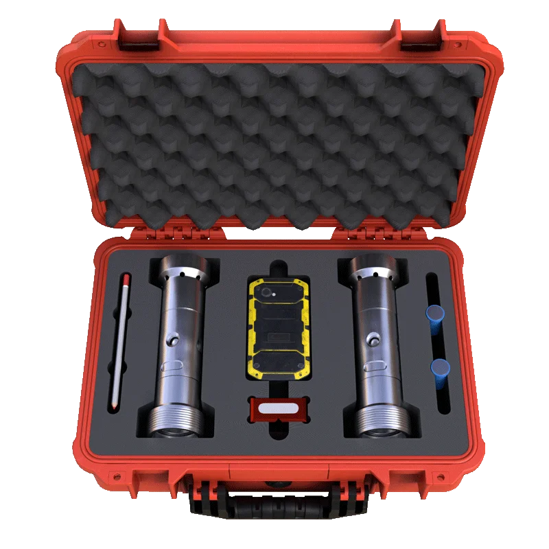
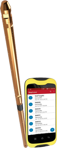
A directional survey tool built on advanced magnetometer sensors, MagCruiser™ auto-aligns to magnetic north with exceptional accuracy and can be operated with minimal training from day one.
In mineral exploration, precision is everything, and yet, borehole deviation continues to compromise data quality and decision-making. Without dependable directional surveys to monitor azimuth, dip, and deviation, core data becomes inconsistent, and geological interpretations lose validity.
Investors and regulators rely on accurate drill logs with verifiable quality control. When the borehole direction is uncertain, mapping errors, repeated measurements, and formation remapping become unavoidable, driving up project costs and timelines.
Ultimately, poor borehole data not only delays progress but can trigger compliance penalties and erode stakeholder confidence in your deposit reports.
The MagCruiser eliminates uncertainty in borehole orientation by utilizing high-precision magnetometer sensors that automatically align with magnetic north, delivering consistently accurate azimuth readings.
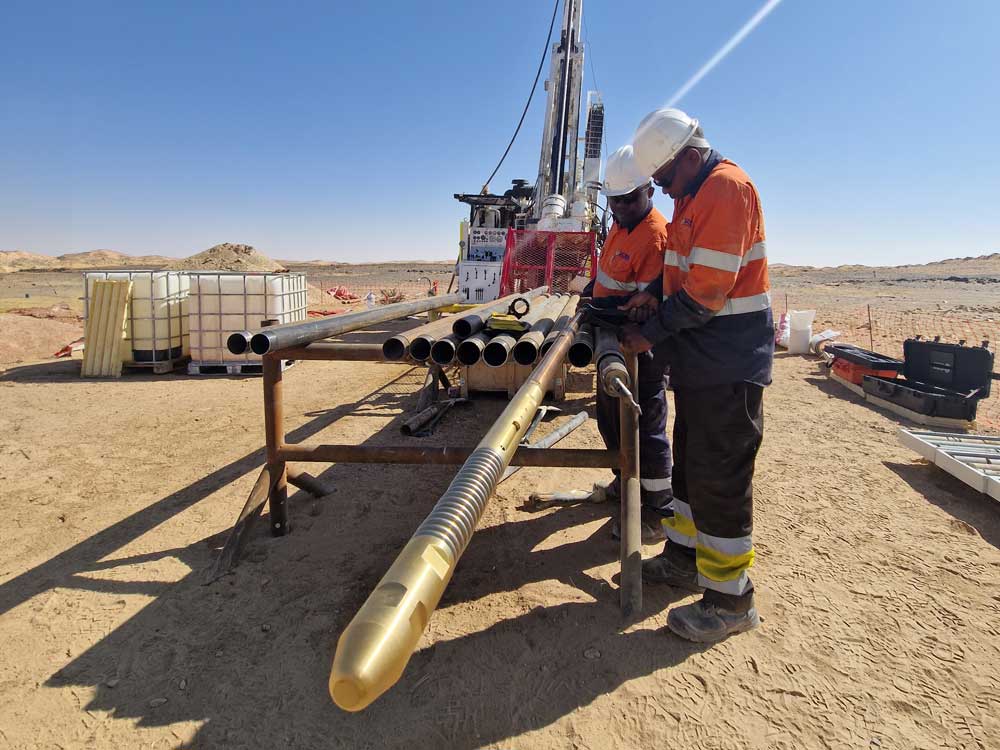
Designed for ease of use in the field, its driller-friendly interface walks operators through each survey step, from setup to data logging, ensuring accuracy even for first-time users.
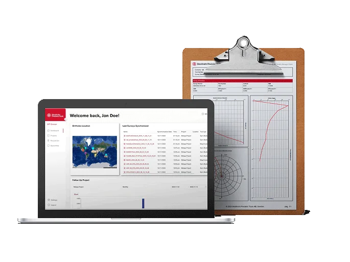
With every run, the MagCruiser™ instantly generates detailed digital reports, providing full traceability, audit-ready data, and total confidence in your borehole quality assurance process.
Clear, step-by-step visual guidance lets drillers operate confidently from day one—reducing training time and minimizing user-dependent errors.
Perform multiple shots accurately aligned to magnetic north to verify azimuth and dip, tighten borehole targeting, and improve QA/QC on every run.
Built for tough field conditions without sacrificing precision. Lightweight and durable so crews can deploy fast and keep working in demanding sites.
Seamless connectivity for traceable, centrally stored survey data. Enable rapid validation, collaboration, and audit-ready reports across your team.
An affordable directional survey solution that delivers professional-grade accuracy—helping you control costs while maintaining high data quality.
MagCruiser™ is the affordable solution for maximum accuracy in non-magnetic environments.
| Dimensions | |
|---|---|
|
Outer Diameter |
35 mm (1.375″) |
|
Length |
1190 mm (46.85″) |
|
Weight |
5.6 kg (12.35 lbs) |
| Operational Environment | |
|---|---|
|
Depth Pressure |
4350 psi |
|
Operational Temperature |
-20°C – +60°C (-4°F – +140°F) |
| Performance | |
|---|---|
|
Azimuth Accuracy |
0.16° |
|
Inclination Accuracy |
0.05°
|
|
Gravity Toolface Accuracy |
0.3° |
|
Magnetic Dip Accuracy |
0.07° |
|
Magnetic Field Accuracy |
± 58 nT |
|
Magnetic Field Range |
-70000 nT – +70000 nT |
|
Azimuth Range |
0° – 360° |
|
Inclination Range |
-90° – +90° |
|
Toolface Range |
0° – 360° |
| Data | |
|---|---|
|
Survey Report |
At any interval |
|
Communications |
Bluetooth® |
|
Export |
SPT SmartCloud via WIFI or 4G LTE |
|
Export Format |
PDF, Excel, CSV, LAS, DXF |
|
Graphic Generation |
2D, 3D |
| Battery | |
|---|---|
|
Battery Type |
Lithium Ion Rechargeable |
|
Operating Time |
1 month of continuous work |
| Handheld Device | |
|---|---|
|
Battery |
20 hrs (8580 mAh) |
|
IP Rating |
IP68, IP69K |


Get a Rental Quote or Buy a GyroMaster™ for Upcoming Survey Projects
Africa Geo-Log & Survey Ltd (AGS) is a Ghanaian mining technology company offering rental, sales, and surveying services with advanced downhole tools, training, and support for mining, civil engineering, and oil industries.
©2026 – Africa Geo-Log & Survey LTD. CO. – All Rights Reserved.
Developed by marketingisprince